
Web Camera Observation Network
Web cameras are a low cost coastal observing platform transforming how environmental monitoring is conducted. Web camera data has demonstrated value to address significant gaps in the nation's ability to monitor and accurately forecast various weather, ocean, ecological and public health hazards. This project, Webcam Coastal Observation System (WebCOOS), promotes low cost webcams to:


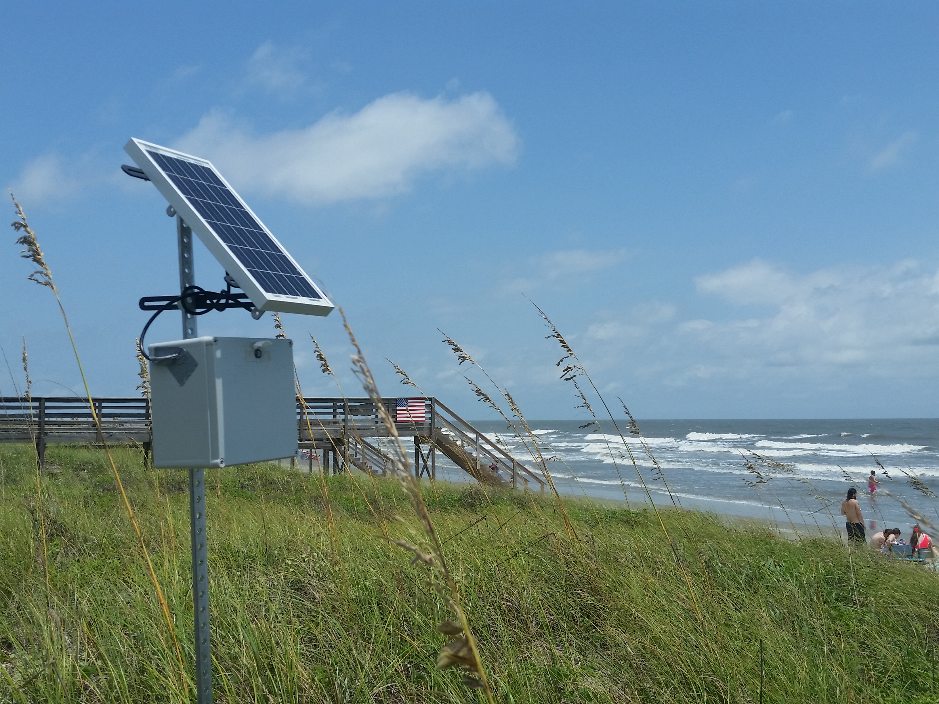
Cameras
News
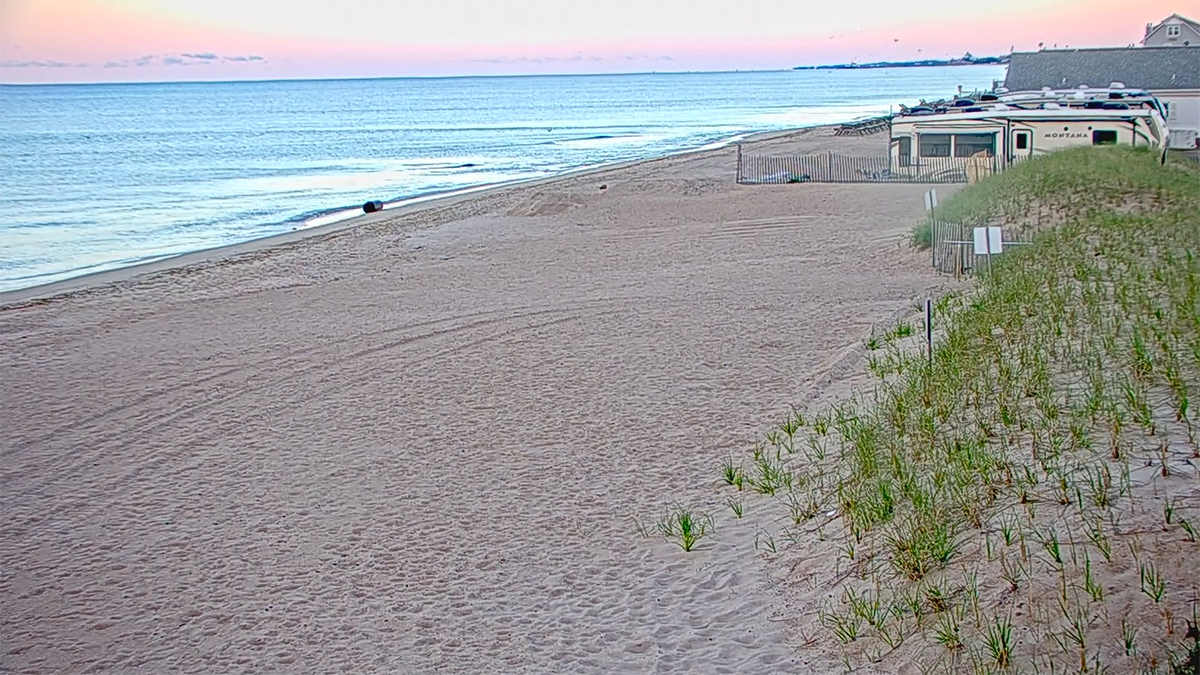
A webcam was installed in Westerly, Rhode Island, to monitor shoreline change and beach usage, in partnership between the Northeast Regional Association of Coastal Ocean Observing Systems (NERACOOS), WebCOOS, Town of Westerly, RI Coastal Resources Management Council, Surfline, and the University of Rhode Island.
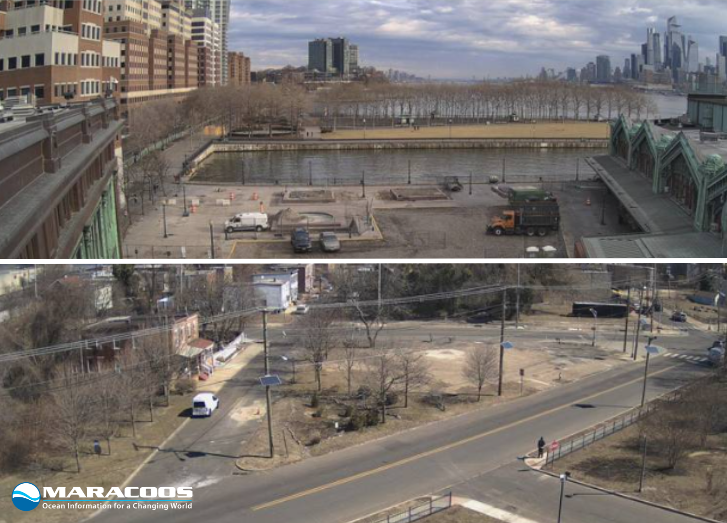
Two new cameras have been integrated in Camden and Hoboken, NJ, to enhance flood monitoring in the Mid-Atlantic, improving public safety and environmental monitoring in coastal communities. This brings the total number of cameras in the WebCOOS network in the MARACOOS region to three, joining an existing camera in Rockaway, NY.
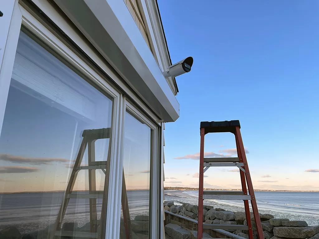
NERACOOS joins the WebCOOS network by installing two new webcams in Camp Ellis, Maine. This partnership with the Maine Geological Survey and the National Weather Service will enhance the monitoring of coastal change and storm impacts.
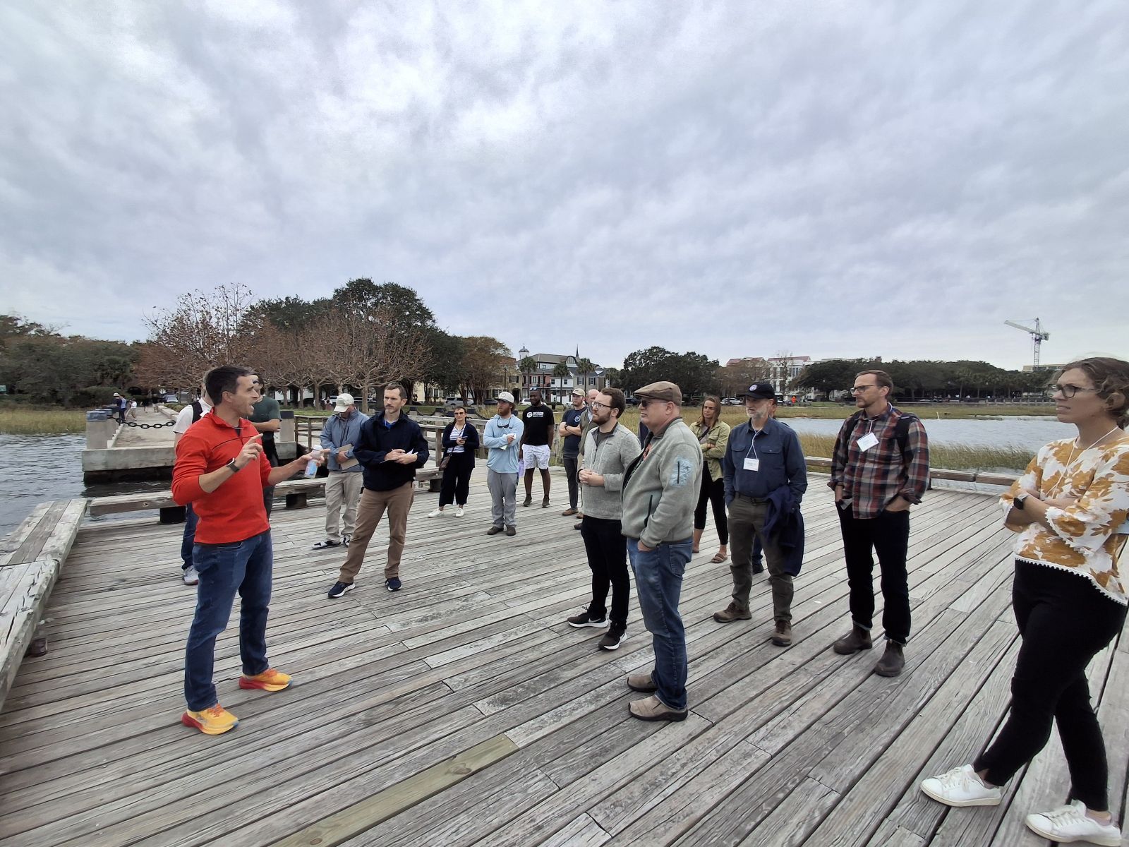
The WebCOOS Technical Workshop brought together the WebCOOS science team and contractors, representatives from multiple IOOS Regional Associations, federal partners, and local community partners on October 9th – 11th, 2024, in Charleston, South Carolina.
SECOORA and NOAA CO-OPS have partnered to provide access to coastal webcam imagery through NOAA’s Coastal Inundation Dashboard.
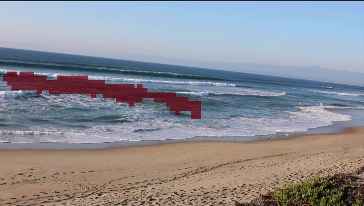
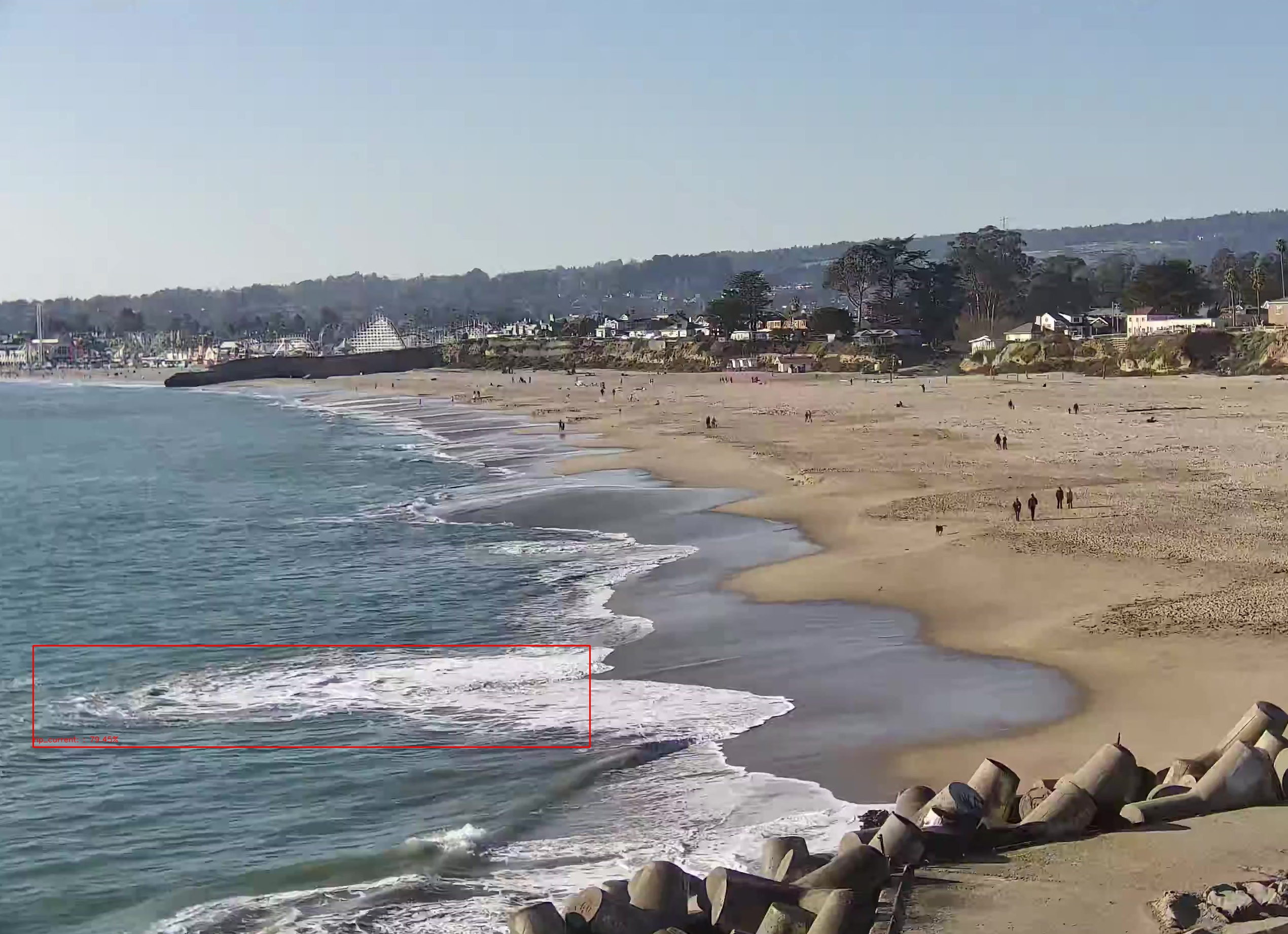
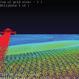
Rip current research by Akila de Silva and other members of the WebCOOS team, including Greg Dusek and Alex Pang, was featured in the 2023 NOAA Science Report. Image source: IEEE Transactions on Visualization and Computer Graphics (2023), CC A-NC-ND 4.0 license.
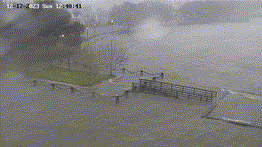
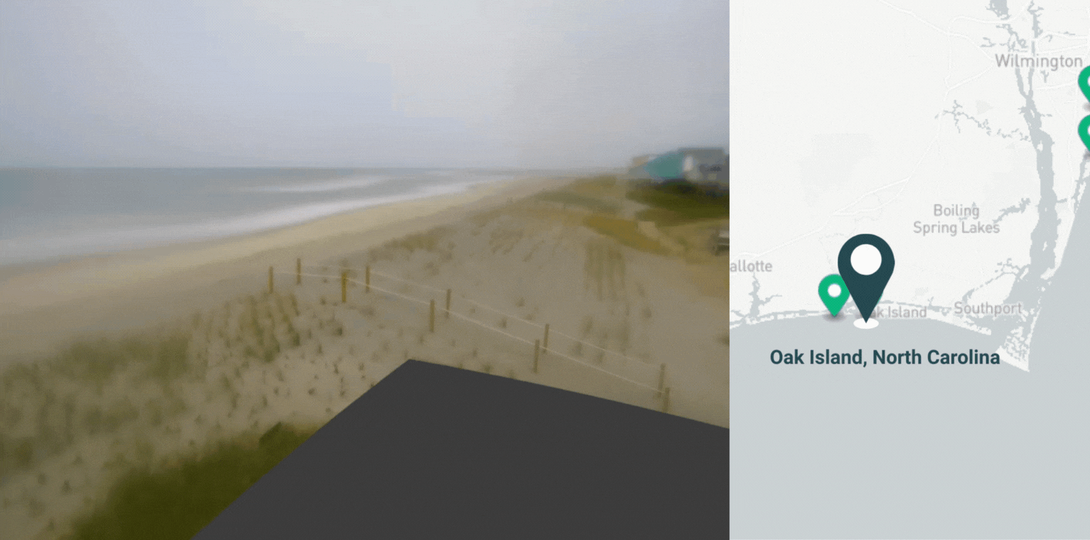
A low pressure storm system brought excessive rainfall and coastal flooding to the Southeast on December 17th, 2023. Web cameras stationed in Charleston, South Carolina and Oak Island, North Carolina captured some of the shocking impacts from this Nor’easter.
Alex Pang, Greg Dusek, and Fahim Hasan Khan were featured in a news story about their work on rip current algorithms related to the WebCOOS project.
The WebCOOS project enters its next phase with funding from a NOAA IOOS Ocean Technology Transition grant!
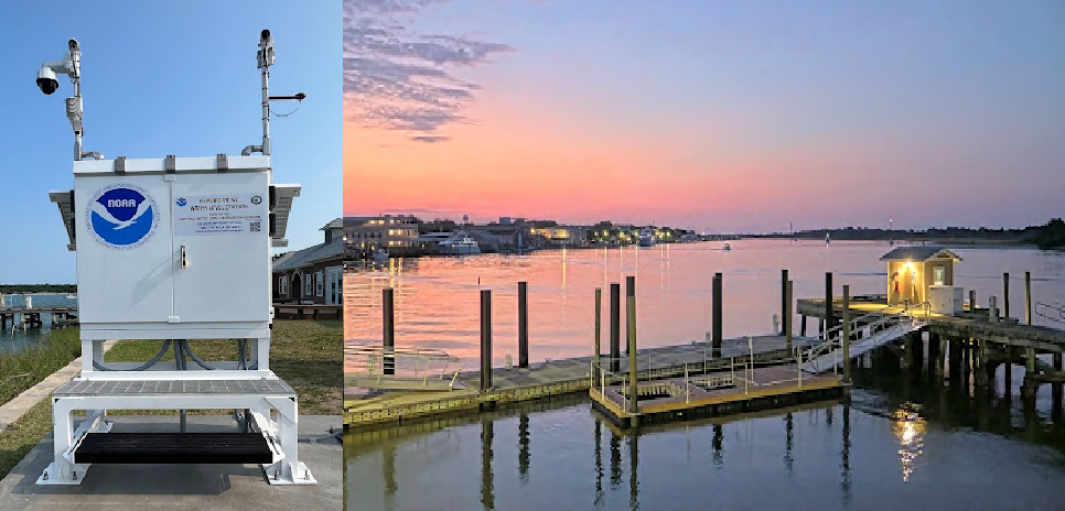
Over six partners have joined forces to install a web camera, water level sensor, and an air quality monitor at the South Carolina Maritime Museum located on the banks of the Sampit River in Georgetown, SC.
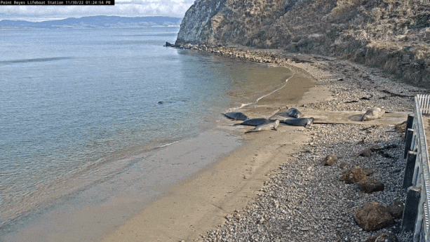
The public can now watch marine mammal releases by The Marine Mammal Center in Point Reyes National Seashore thanks to a new partnership with WebCOOS.
The WebCOOS website was shared as Hurricane Ian was approaching. This new observing system allows users to stream live camera feeds in real-time in some locations, and see snapshot images in other locations.
NOAA released a new operational rip current model that will improve beach safety through sophisticated rip current forecasts. NOAA plans to validate the model using shoreline footage from SECOORA's Webcam Coastal Observation System (WebCOOS) network.
SECOORA was awarded a $1.1 million grant to launch a sustained network of low-cost webcams throughout the Southeast, which will build off of the successful pilot project, the Web Camera Applications Testbed.
SECOORA's 2019 Data Challenge Winner, Matthew Conlin, a PhD student at the University of Florida, has developed an easy tool to remotely calibrate web camera images for use in measuring changes in coastal and nearshore environments.